Access to green areas and public realm: the case of Milan
The study follows an analytical approach aiming to address the transition of the city towards a wider and more homogeneous supply of public space.
As it is now known, the current pandemic is affecting change in consolidated social behaviours, which resonates particularly in urban areas. Indeed, it is precisely in such realities that the community can rediscover the importance of access to open-air gathering spaces and realize, in many circumstances, the lack of easily accessible public spaces on foot from home.
Systematica aims at supporting the evolution of urban planning by adopting analytical tools to quantify emerging needs and to outline targeted responses to these new collective requests.
Public realm survey
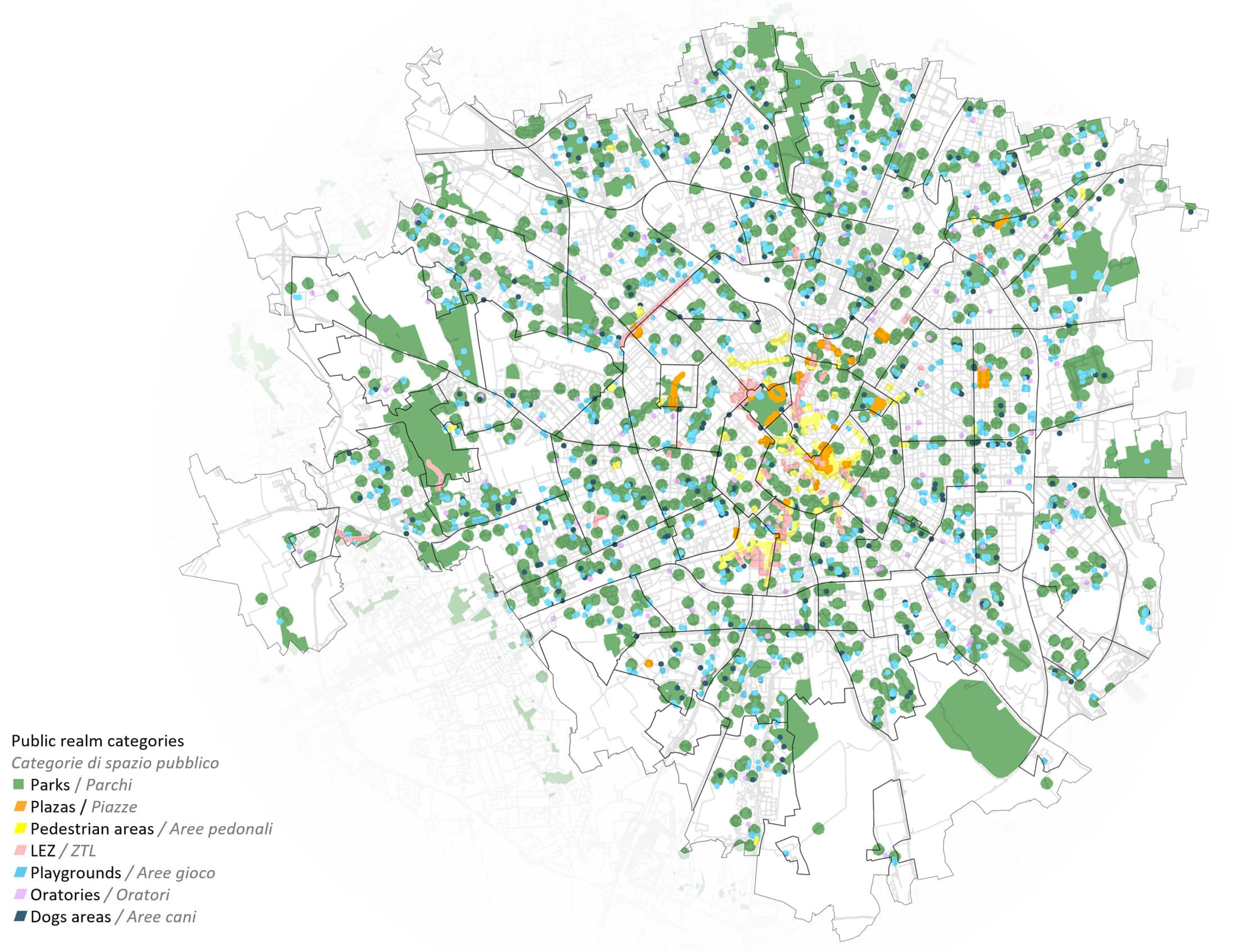
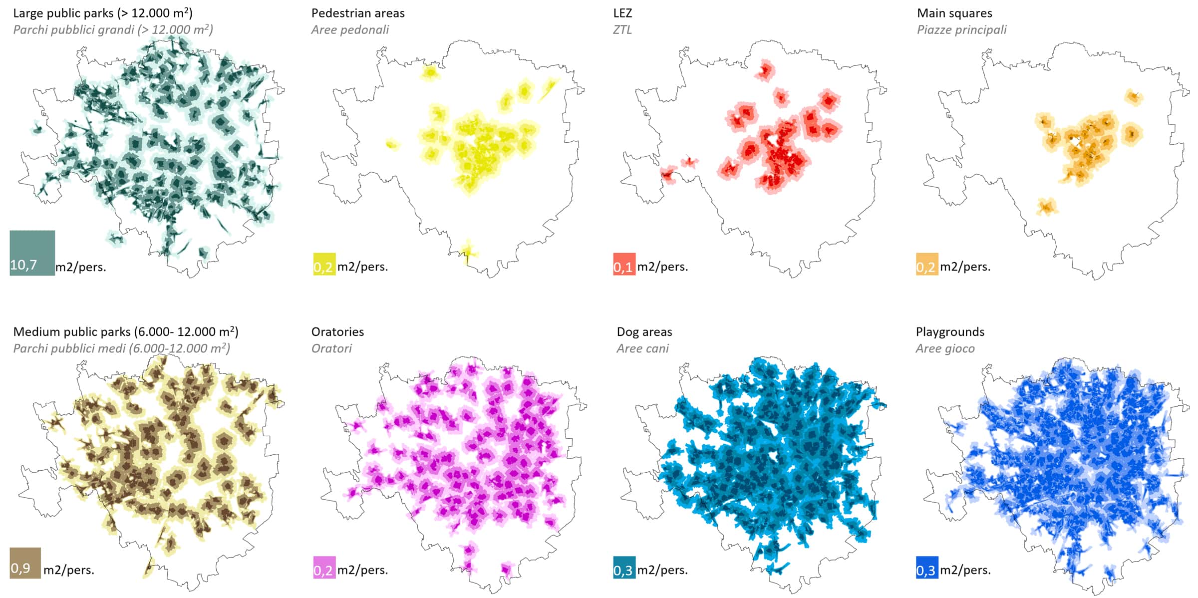
The study originates from a comprehensive survey of Milan’s public space. Data collected from official sources and platforms are integrated with ad-hoc researches to create an atlas of the main categories of public spaces such as parks, gardens, dog areas, oratories, plazas and pedestrian areas.
Accessibility to gathering areas
15-minute accessibility to urban parks
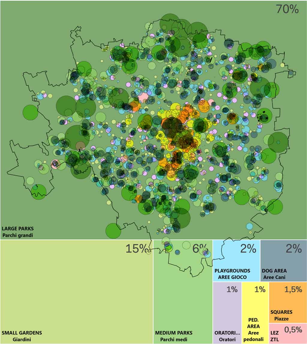
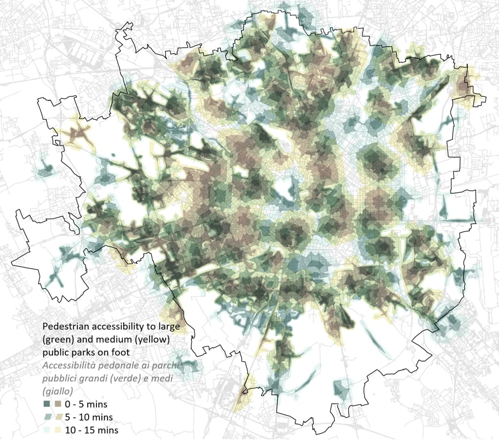
The isochronal analysis allows identifying urban areas whose residents live less than 15 minutes away on foot from a specific point. This analysis is conducted for all categories of public spaces investigated in the study, as shown in the following. This reading of the city brings out the number of inhabitants able to reach a recreational area in less than 15 minutes and the urban areas least served. Investigations show that the distribution of medium and large public parks leaves some areas of the city uncovered. The diffusion of other recreational areas reduces this deficiency by ensuring a widespread coverage of the city. Nonetheless, the supply of these areas is reduced, resulting in 1.4 sqm per capita, on average.
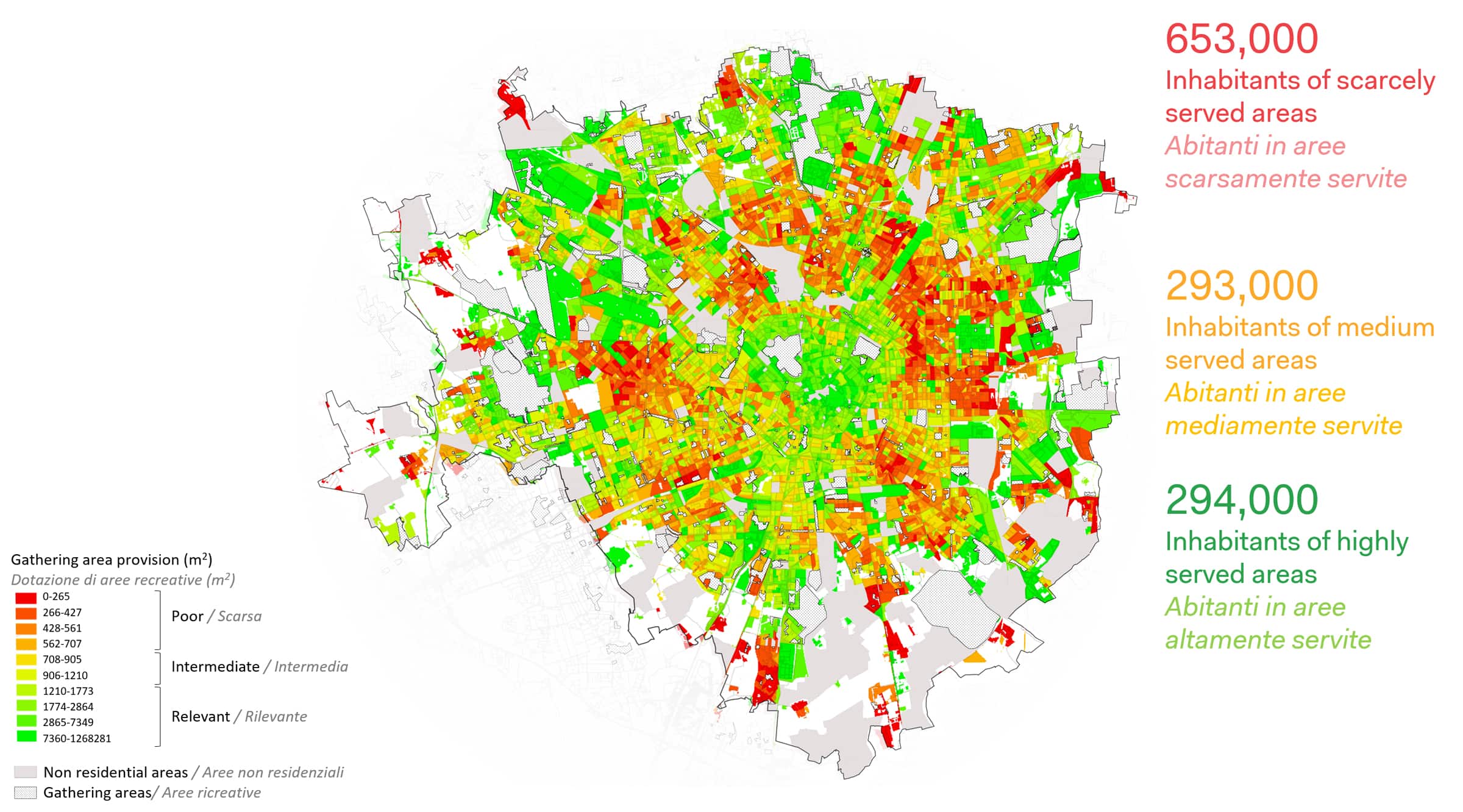
Gathering areas reachable in 15 minutes per inhabitant
The map shows the detailed processing of the results obtained through the isochronal analysis. The analytical process starts with the public space provision within 15 minutes from each census cell. Then, information about the residing population is analyzed. The methodology allows us to obtain a synthesized reading of the municipal area that compares the population density with the availability of recreational areas within 15 minutes from each census cell. The chromatic scale identifies the total amount of recreational areas available to each resident within 15 minutes. As shown on the map, more critical zones are located in proximity to the external ring-road, with episodic extensions along the north-east, south-east and west axial roads.
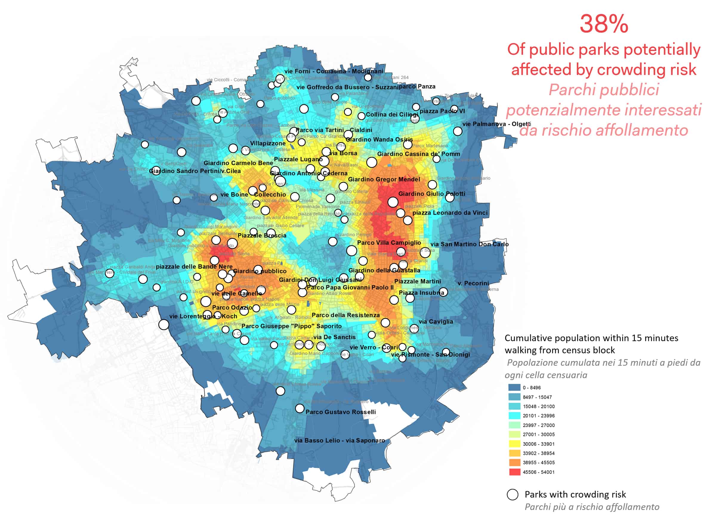
Crowding risk in public parks
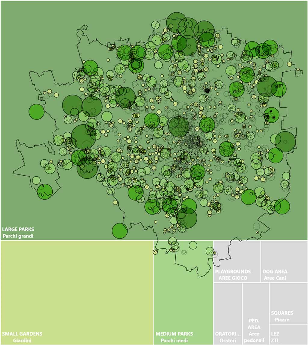
As highlighted through the survey of Milan’s public realm, parks play the greatest role among all urban recreational areas. Based on their size and proximity to residential areas, a map of crowding risk is produced. The exercise is carried out considering the area provision per resident within 15 minutes from each park. Green areas providing less than 2 sqm per resident are considered potentially affected by crowding risk.
Seeking an equilibrium
Main clusters for enhancement
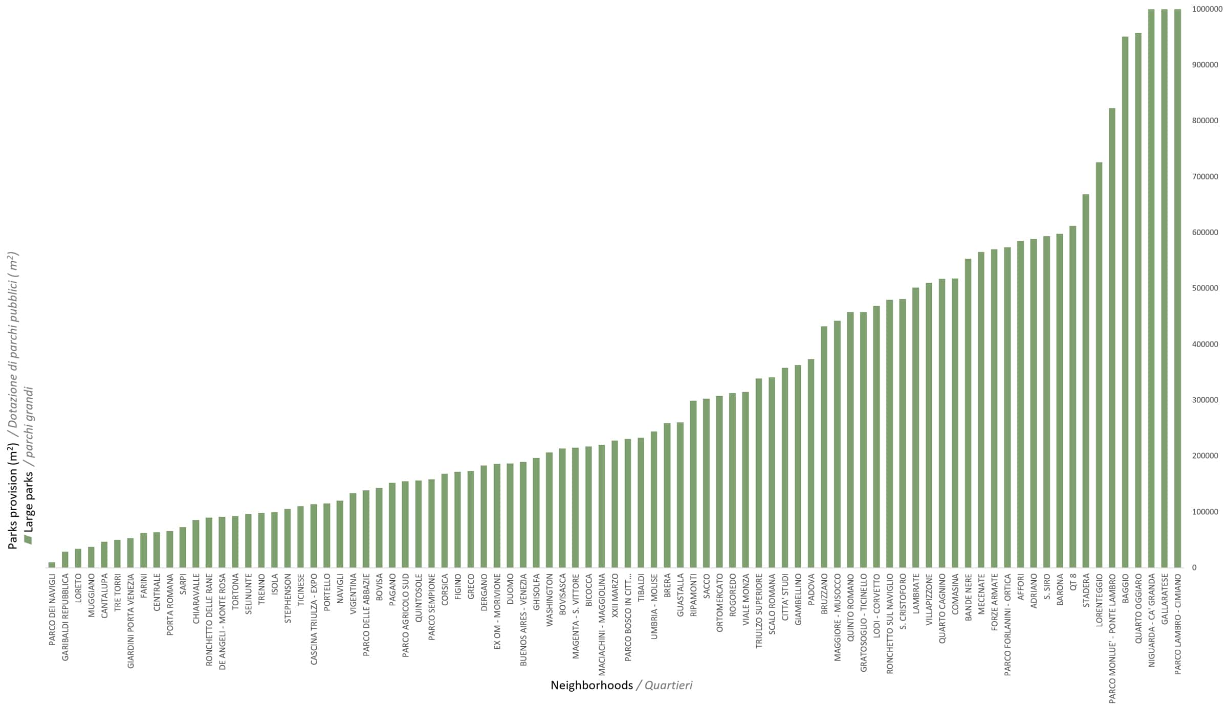
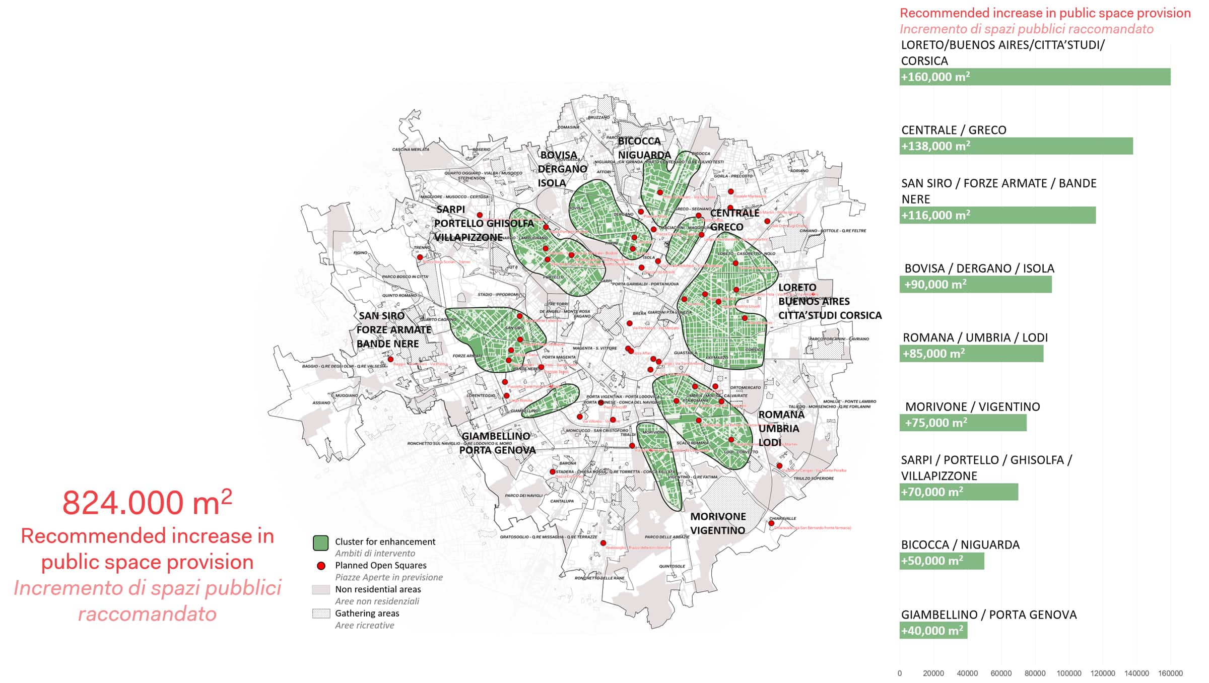
The analytical process leads to the identification of some urban areas with less widespread and less extensive availability of public spaces in relation to the residing population. The map groups these areas into 8 main zones affecting 25 Milanese neighborhoods. For each of them an increase in public areas is suggested based on the intermediate urban provision. The increase reflects the possibility of citizens to have a total amount of 1,000 sqm of public space within 15 minutes from their residence. This value would bring the areas concerned closer to the public space provision level currently present in the southern area of the city (Porta Lodovica, Porta Ticinese, Porta Vigentina).
Enhancement strategy
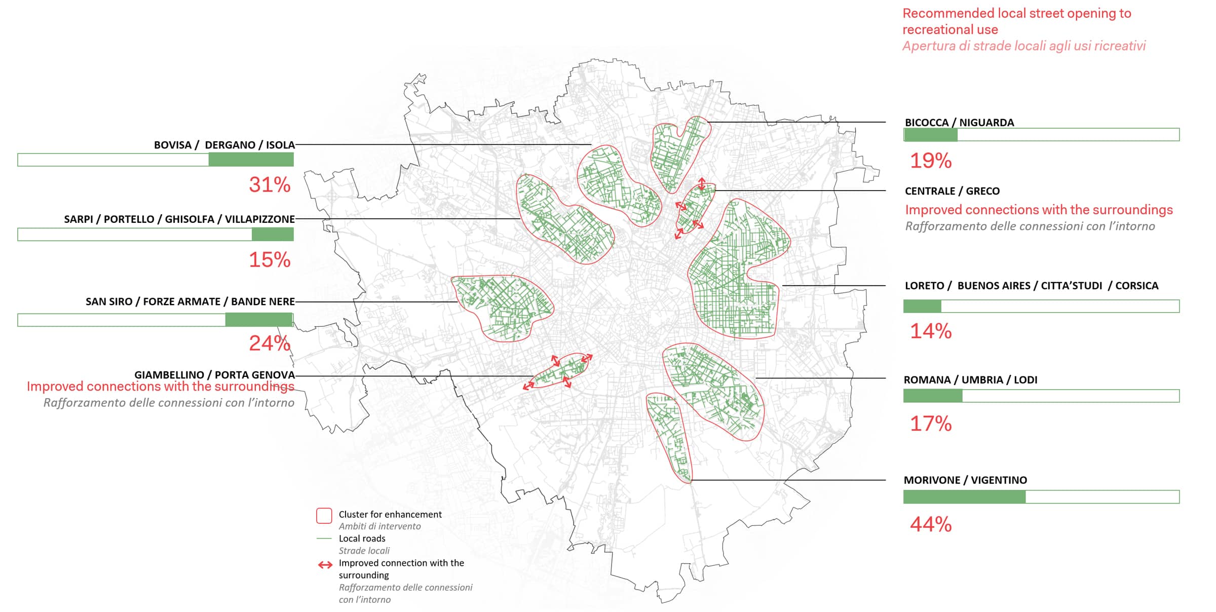
Among the proposed interventions aimed at increasing public space, the capillary local roads network, green in the map, can play a crucial role. The quota of local roads potentially closed to vehicle traffic are reported in red. This strategy can be implemented temporarily during the pandemic spread or occasionally during weekends to ensure the enhanced provision of secure public spaces where needed. Some of these transformations can hopefully become permanent in order to give a balanced accessibility to public realm to residens.
