


ROUTES, or Reimagining Open schoolyards and Urban sTreets as Equitable Spaces, is a four-year Horizon Europe and New European Bauhaus project, coordinated by Delft University of Technology and funded by the European Union under the topic, HORIZON-NEB-2025-01-PARTICIPATION-0: The impact of common space on neighbourhood communities. The project runs from September 2026 to August 2030.
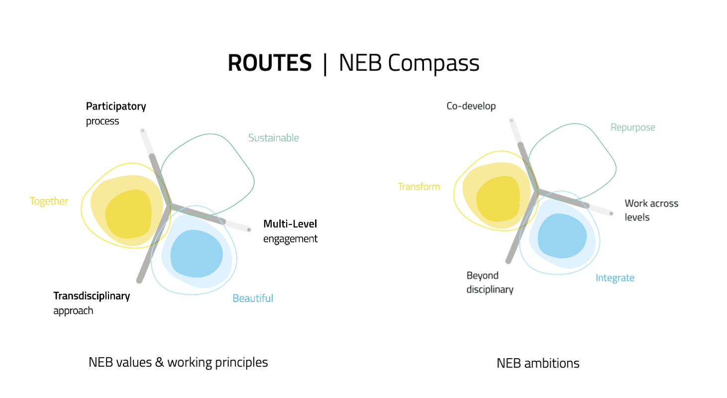
ROUTES will operationalise the New European Bauhaus (NEB) Compass working principles by turning the values of beauty, sustainability, and togetherness into spatial, social, and governance innovation. The project embodies these principles through participatory processes and sits at the ambitious end for participation and transdisciplinarity, because co-design runs through every stage of the work.
Project Description
ROUTES is grounded in the idea that schoolyards and school streets often do not fulfil their potential as exemplary common spaces. This is particularly significant given that nearly 88% of households in the EU live within a 15-minute walk or cycle of a schoolyard or school street, making these spaces among the most evenly distributed public spaces in Europe.
Across Europe, schoolyards and their surrounding streets are usually treated as separate entities, governed by different policies and authorities. This fragmentation is one of the factors preventing them from becoming catalysts for their neighbourhoods and functioning as safe, green, and inclusive public spaces.
ROUTES aims to rethink schoolyards and school streets by bringing together citizens, students, parents, teachers and local authorities to co-design tactical, integrated interventions in eight living laboratories across four pilot cities: Bratislava, Espoo, Rotterdam, and Tirana.
Four additional cities participate in capacity-building activities and will help validate the tools and policy recommendations developed by ROUTES. The observer cities are Braga, Kocaeli, Lund, and Nantes.
The project will measure the effects of these interventions on neighbourhood safety, inclusivity, social cohesion, mobility behaviour and subjective wellbeing.
ROUTES combines methods from urban analytics, citizen science, environmental psychology, behavioural science, tactical urbanism, and co-design. The resulting evidence will be translated into practical tools, indicators, and policy guidelines that make it possible to scale successful transformations across Europe.
Consortium and Partners
ROUTES brings together 16 partner organisations across 8 European countries, spanning research institutions, local governments, design agencies, and community organisations.
Research and Academia
Cities and Public Agencies
Community, Practice and Innovation
Transform Transport’s Role
Transform Transport’s contribution is spread throughout the project, from project management and coordination, to monitoring and framework evaluation, comparative data analysis and ROUTES co-development, and community engagement.
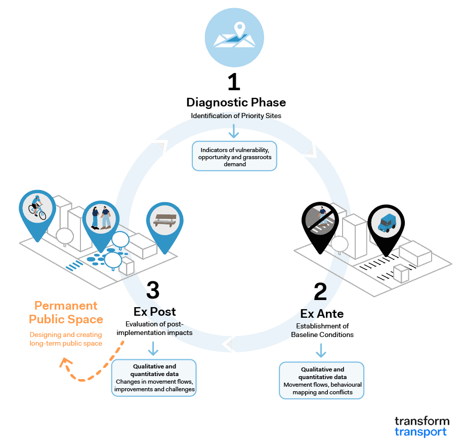
In particular, Transform Transport will take a lead role in data collection and integration, analysis protocol, comparative analysis across the pilot cities, and systematic stakeholder engagement, community participation, and contextual understanding. The latter includes the development of a consistent baseline across all pilots. This will cover school profiles, neighbourhood demographics, the physical environment, mobility and safety patterns, community use, existing interventions, and spatiotemporal service accessibility.
Transform Transport will bring its expertise and knowhow from multiple projects and ongoing initiatives to ROUTES, including:
- Expertise in developing and automating scalable, data-driven mobility metrics
- 15min City Score Toolkit – Urban Walkability Analytics: an open-source Python tool using OSM data to measure walkable service access in more than 100 cities; now refined with population-weighted scoring and developed into an interactive online tool, the 15 Minute City Score Europe Map.
- Expertise in stakeholder engagement and data visualisation for public use
- Walkability for Children in Bologna: GIS and Space Syntax Applications: developing a multi-scale, user-centric methodology to inform mobility and public space policies in the city of Bologna.
- Tracce: ICTs in Support of Monza’s PEBA – Plan for Eliminating Architectural Barriers: mapping the factors that limit mobility autonomy of people with reduced mobility through a Web GIS for developing a reference framework on the level of accessibility of pedestrian infrastructure and a Web App for route planning and the reporting of critical issues.
- Expertise in monitoring and integrated approaches supporting informed decision-making
- From Urban Evidence to Public-Space Design: Piazza della Pilotta in Rome: an evidence-based urban design process for the regeneration of Piazza della Pilotta in Rome through the application of a multi-scalar methodology combining GIS-based proximity analysis, thermal comfort modelling, video analytics, behavioral mapping, pedestrian counts, and surveys.
- Monitoring Tactical Urbanism for Urban Planning: Insights from Bologna: a study exploring how monitoring becomes a structural component of the planning process when supported by data and participatory processes, such as GIS accessibility mapping, video analysis, TomTom data, and citizen engagement.
Acknowledgments
ROUTES has received funding from the European Union under Grant Agreement No 101308841. Views and opinions expressed are however those of the author(s) only and do not necessarily reflect those of the European Union or the European Commission. Neither the European Union nor the granting authority can be held responsible for them.

Programme: Horizon Europe Research and Innovation Action
Call HORIZON-NEB-2025-01 (New European Bauhaus)
Project no. 101308841
Duration: 48 months