This book is a structured collection of the most insightful investigations developed by Transform Transport since the Covid-19 outbreak. The unprecedented disruption caused by the pandemic has given rise to ...
Abstract The research is based on an extended spatial analysis executed through the application of GIS and Space Syntax, aiming at assessing the level of walkability for children in the ...
On May 13th, 2021 Systematica joined a roundtable discussion at the 6th Biennale dello Spazio Pubblico – BISP 2021, the biannual event dedicated to research, activities and practices devoted to ...
A professional case study in Torrance, California Introduction In 2016, we were appointed to study mobility dynamics in the city of Torrance, a city of roughly 100,000-inhabitants located in the ...
The development of new technologies is shaping the growth of cities in many ways. Among these, the Internet of Things (IoT), Artificial Intelligence (AI), the high-resolution global positioning system (GPS), ...
Proximity, density and diversity: Local centers to support living at neighborhood-scale The Covid-19 pandemic has dramatically influenced the way we live and move. Movement within the city has been dramatically ...
Sustainable mobility and walkability The rising demand for transport services and infrastructure linked to urbanization (United Nations, 2014) requires an institutional process to effectively design and plan future cities. This ...
This article is based on the results of the study Milan sidewalks, in which the width of all the sidewalks of Milan has been mapped and narrow sidewalks were classified ...
Vehicle speed is the element that has the major impact on the road character and the way it is used. Lower speeds encourage an urban type of development while increasing ...
The introduction of greenery and vegetation requires great coordination among all consultants and designers throughout the different project phases. Vegetation is one of the few elements that is able to ...
E11 is the longest road in the UAE: it connects the entire country crossing six of the seven Emirates, from the Western border with Saudi Arabia to the Northern one ...
Pedestrian Level Of Service (PLOS) is being increasingly used to assess safety and comfort levels across entire cities, providing effective indications on priority of interventions. With the increase of car-dependence, ...
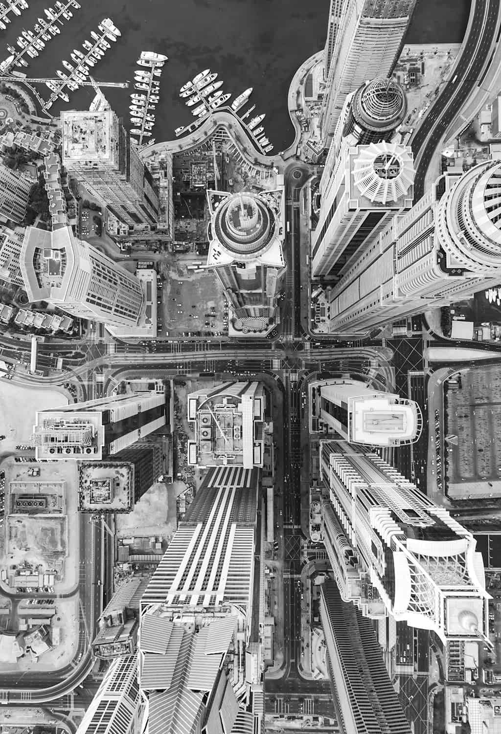
Block sizes, junctions spacing and the density of intersections have the greatest impact on the public realm and the pedestrian behavior. Al Wasl Road is a great reference to see ...
Since the late 1970s, network theories are used to study, understand and plan cities. Very few urban theories succeed in describing our cities in such robust and convincing manner like ...
There are two types of bus stops in Dubai: the majority is the standard pole, with simple bus line information and time schedule and a growing number of air-conditioned stops, ...
Several streets are surveyed in depth to identify the recurring dimensions and proportions that characterize Dubai streets. The way a street is used is strongly related to allocation of space ...


")


